
Accurately appraising the value of land is essential for both sellers and buyers. Understanding the true worth of a piece of land can guide you in setting the right price, negotiating effectively, and planning future investments. There are several factors and methods that professionals use to determine land value, and knowing these can make a significant difference in achieving successful transactions.
The value of land is influenced by various factors such as its location, zoning, and physical characteristics. Each of these factors plays a crucial role in determining the property’s market value. Additionally, the methods for appraising land value, including comparative market analysis and income capitalization, provide structured approaches to valuation. These methods consider various aspects like comparable sales, potential income, and developmental costs.
With advancements in technology, tools like GIS mapping, online valuation calculators, and drones have become integral in the appraisal process. These technologies offer precise data and enhanced visuals, making it easier to assess land value accurately. Moreover, understanding legal considerations and staying updated on market trends are essential to navigate potential challenges and capitalize on opportunities in land valuation. By mastering these aspects, we can ensure that our appraisals are both accurate and beneficial.
Key Factors in Land Valuation
Location and Zoning
Location is one of the most important factors in determining land value. Proximity to amenities such as schools, shopping centers, transportation hubs, and recreational areas can greatly enhance a property’s appeal. A plot of land in a well-developed area is likely to have a higher value compared to one in a remote location.
Zoning laws also play a critical role. Zoning dictates how the land can be used—whether for residential, commercial, agricultural, or industrial purposes. Being aware of these regulations helps in understanding the land’s potential uses and limitations. For instance, land zoned for residential use in a growing urban area might command a higher price than agricultural land in a rural setting.
Size and Shape of the Land
The size and shape of a parcel can significantly affect its value. Larger plots generally have more market value, but this can vary depending on the location and intended use. For example, a larger lot in a desirable residential neighborhood is often considered a premium asset.
The shape of the land matters too. Irregularly-shaped parcels may have limitations that affect usability, making them less attractive to potential buyers. Conversely, square or rectangular lots are easier to develop and therefore can have higher market appeal. When assessing land value, consider both the total area and the layout to determine how these factors might influence usability and desirability.
Environmental and Topographical Features
Environmental and topographical characteristics also influence land value. Features such as rivers, lakes, hills, and forests can add aesthetic value and enhance the appeal of the land for specific purposes like residential or recreational use. However, these features can also present challenges, such as flood risks or the need for extensive land leveling.
Soil quality and terrain are important as well, particularly for agricultural land. Fertile, well-draining soil can increase the land’s value, while rocky or swampy areas may lower it. Evaluating these physical attributes helps in understanding the pros and cons of the property and setting a fair price.
Methods for Appraising Land Value
Comparative Market Analysis
A Comparative Market Analysis (CMA) is one commonly used method for appraising land value. This approach involves comparing the subject land with recently sold parcels that are similar in size, location, and use. By examining the sale prices of these comparable properties, we can estimate the market value of the land.
To perform a CMA, gather data on recent sales in the area and look for similarities in terms of zoning, accessibility, and available utilities. Differences between the properties should be noted and adjustments made to reflect these variations. This method provides a benchmark based on current market conditions, helping to set a realistic price.
Income Capitalization Approach
The Income Capitalization Approach is used mainly for income-producing properties. This method calculates the value of the land based on the income it can generate. For example, agricultural land that produces crops or land that can be leased for commercial use would fit this category.
To use this approach, first determine the annual income the property is expected to generate. Then, apply a capitalization rate, which is a measure of the return on investment typically expected by investors. The formula is straightforward: Land Value = Annual Income / Capitalization Rate. This method provides a clear picture of the land’s income potential, which is crucial for investors.
Cost Approach for Undeveloped vs. Developed Land
The Cost Approach estimates land value based on the cost to develop it, minus any depreciation. This method is useful for both undeveloped and developed land. For undeveloped land, it involves calculating the cost of making the land usable, including clearing, grading, and installing utilities.
For developed land, the approach considers the cost of constructing any existing structures and improvements. Depreciation is then subtracted to account for wear and tear or obsolescence. This method works well for properties with unique features or those in areas with limited market data, providing an alternative way to estimate the property’s value.
Using Technology in Land Valuation
GIS Mapping Tools
Geographic Information Systems (GIS) mapping tools offer advanced methods for evaluating land. GIS technology allows us to visualize, analyze, and interpret geographic data, making it easier to assess land value accurately. By layering different types of data, such as soil types, vegetation, and nearby infrastructure, GIS provides a comprehensive view of a property’s characteristics. This holistic approach helps in identifying features that might enhance or detract from the land’s value.
Moreover, GIS mapping can highlight zoning boundaries, flood zones, and areas prone to natural disasters. This information is crucial for making informed decisions about land use and development. Using GIS, we can streamline the appraisal process and provide detailed, visually appealing maps that support our valuation assessments.
Online Valuation Calculators
Online valuation calculators are practical tools for initial assessments of land value. These calculators use algorithms based on current market data, comparable sales, and other relevant factors to provide an estimated value. While these tools shouldn’t replace professional appraisals, they offer a quick and convenient way to get a ballpark figure.
To use an online valuation calculator, input details such as the land’s size, location, and zoning information. The tool then processes this data and generates an estimate. It’s a useful starting point that can help landowners and buyers set realistic expectations before seeking a formal appraisal.
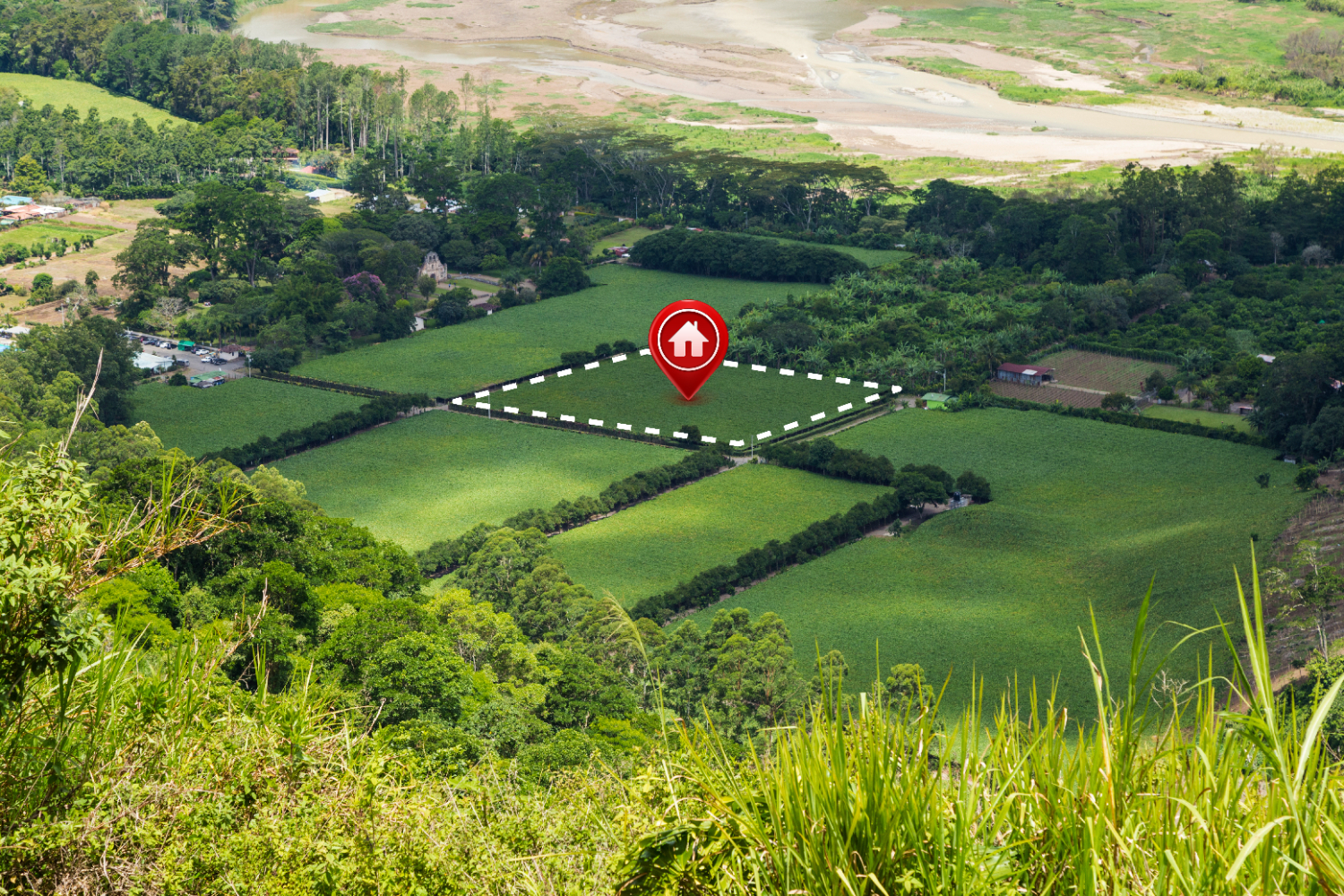
Drones and Aerial Imagery
Drones and aerial imagery have revolutionized land appraisal techniques. They offer a bird’s-eye view of the property, making it easier to assess its features and conditions. Drones can capture high-resolution images and videos, providing a detailed and accurate visual representation of the land.
Aerial imagery helps identify topographical features, vegetation coverage, and potential issues like erosion or waterlogging. It also provides a clear view of the land’s boundaries and surrounding areas. By offering these detailed visuals, drones enhance our ability to appraise land accurately and highlight its unique attributes.
Legal Considerations and Market Trends
Understanding Local Land Use Regulations
Local land use regulations play a significant role in determining land value. These regulations govern how land can be used, dictating whether it is suitable for residential, commercial, agricultural, or industrial purposes. Knowing these rules helps in understanding the land’s potential and limitations.
It’s essential to research zoning ordinances, building codes, and environmental regulations in the area. Some regulations may restrict certain types of developments, impacting land value. Compliance with these rules is crucial for avoiding legal issues and maximizing the property’s potential.
Current Market Conditions and Their Impact on Land Value
Market conditions are a vital factor in land valuation. Economic trends, supply and demand, and property market dynamics all influence land prices. During periods of economic growth, land values tend to rise due to increased demand for development. Conversely, economic downturns can lead to lower land values.
Keeping abreast of market trends helps predict future land value changes. Factors like interest rates, population growth, and development projects in the area also impact land value. Staying informed about these conditions allows us to make strategic decisions and provide accurate valuations.
Preparing for Potential Legal Challenges in Valuation
Legal challenges can arise during the land valuation process. Disputes over property boundaries, zoning changes, or environmental regulations can impact the value assessment. Preparing for these challenges involves thorough research and documentation.
Ensure all legal aspects of the property are clear, including titles, easements, and zoning classifications. Consulting with legal experts can help address potential issues before they escalate. Being proactive in understanding and resolving legal matters ensures a smoother valuation process and avoids costly delays or disputes.
Conclusion
Accurately appraising land value requires a comprehensive understanding of key factors, valuation methods, and the latest technological tools. By considering aspects like location, zoning, and environmental features, we can better assess land potential. Implementing structured appraisal methods such as comparative market analysis and income capitalization, combined with technology like GIS mapping and drones, enhances accuracy.
Staying informed about local regulations and market trends is equally important for making informed decisions. Legal considerations can affect land valuation, so it’s essential to prepare for potential challenges. By understanding and mastering these components, we can ensure that our land appraisals provide realistic and beneficial insights.
For professional guidance on appraising your land’s value and expert support to buy and sell land, reach out to 7Land Corp today. Our experienced team is here to help you navigate the complexities of land valuation and achieve the best results. Contact us now to get started!